Clouds are gathering on the horizon, the actual wind is diverging from the morning forecast, and the yacht is just crossing the Gulf Stream. Will the boat withstand the approaching 45-50 knot squall? In such a situation, the key question is: how much time is left to maneuver, is the current cooperating, and is it time to seek shelter?
Weather on an ocean voyage rarely matches the original plan from the first to the last mile. The warm waters of the Gulf Stream can speed up a passage, but can also greatly intensify thunderstorms. A deep cyclone or tropical storm often cuts off access to safe harbor. Therefore, the safety of an ocean voyage depends on how quickly the crew correlates model data, instrument readings, and onboard observations to furl sails or change route in time.
Why does the Gulf Stream change the weather conditions during the transition?
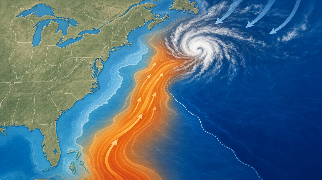
The Gulf Stream originates from the Equatorial Current. Strong easterly winds in the North Atlantic push water away from the coast of Africa, after which the current divides. This forms the Florida Current, which rises north along the east coast of the United States. The continental shelf and deep water determine its course, so the northern boundary of the current runs close to the continental shelf.
Despite its variable depth, it's a surface current. The Gulf Stream crosses the Atlantic, transporting vast masses of warm water. This warmth acts as fuel, providing energy for weather systems that form over the ocean or originate from the continent.
In practice, it looks like this: a typical thunderstorm emerges from land toward the Atlantic. Upon reaching the Gulf Stream—especially its northern boundary—it encounters rapid heating. Explosive development begins: cloud tops rise higher, vertical instability increases, and convective energy increases. As a result, the wind intensifies sharply, and downbursts strike more frequently and powerfully.
The Gulf Stream-weather relationship is especially critical during the passage of a cold front, trough, or low-pressure area. Under such conditions, thunderstorms become more numerous and intense. Their peak activity typically occurs in the afternoon and early evening, when solar heating, current heat, and coastal processes combine. Therefore, when planning a passage, it's important to compare the flow's position with the frontal forecast and calculate the time it will take to pass through the danger zone.
How to prepare your boat for squalls and use the current without unnecessary risk
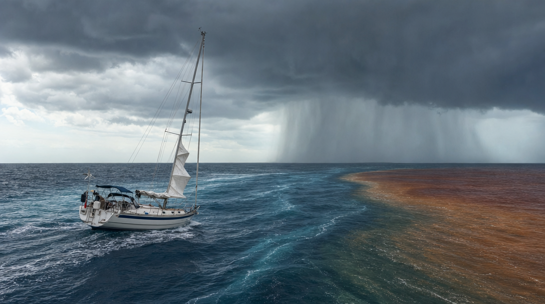
In the Gulf Stream region, squalls should be taken for granted. There are known cases of heavy yachts with high righting momentum sailing through stormy weather with gusts of up to 45–50 knots, using a flat mainsail and slack sails, simply easing off the wind. However, this tactic isn't suitable for everyone.
How do you prepare a yacht for a squall if it's light and modern? A light yacht with a lower righting moment requires a different approach. Here, the crew must reef much earlier and be ready to quickly lower or raise the sails. Sometimes bearing downwind and furling the jib two or three feet helps, but the choice of maneuver always depends on the stability of the individual boat and the speed of the squall.
In addition to squalls, the route is complicated by warm and cold meanders—ring-shaped currents that separate from the main current. Warm meanders rotate clockwise, while cold meanders rotate counterclockwise. Most of them eventually rejoin the Gulf Stream. Taking advantage of the direction and speed of these rings can provide a significant tactical advantage when crossing the current or en route to Bermuda.
A long detour to follow a meander doesn't always pay off. A wrong tack will cause the boat to go against the current and spend much more time in the danger zone. The benefit of the current is only meaningful when it correlates with the yacht's actual speed. The rule is simple: stay in the downstream current, and exit the headstream as quickly as possible.
- Expect squalls in advance and be prepared to take reefs early.
- Choose tactics taking into account the righting moment and the safety margin of the vessel.
- Check whether the meander actually increases the transition speed, and not just looks nice on the map.
- Immediately change course to exit the area where the current begins to slow down the yacht.
How to compare forecasts with what's happening on board
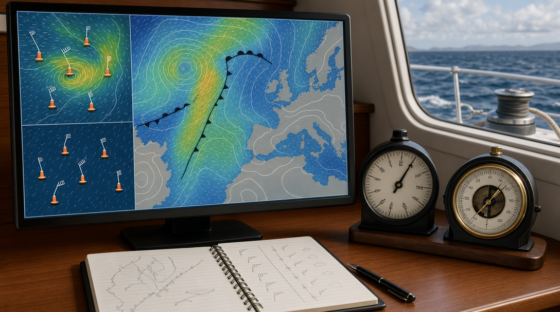
Understanding how to check a weather forecast at sea begins with the local picture. A typical VHF forecast reports the situation in a specific area: whether there are warnings, thunderstorms, or strong winds are expected. Next, it's worth turning to more detailed data, such as National Weather Service reports, which include information from the Ocean Prediction Center, the National Hurricane Center, and the Storm Prediction Center.
- Obtain a model and synoptic picture. Resources like the Ocean Prediction Center publish current weather maps and forecasts for 24, 48, and 96 hours. These typically include GFS model data and reports compiled by professional meteorologists.
- Check the forecast with reality. National Buoy Center stations broadcast actual wind speed and direction, atmospheric pressure, water temperature, and wave height off the coast.
- Track the movement of clouds and precipitation. Doppler radar clearly shows where a weather system is currently located and where it is moving relative to your course.
- Update data at the first discrepancy. If the actual wind is significantly higher or lower than the model predicts, you should request fresh reports and reconsider your tactics for the coming hours.
Mushroom files: a utility model, not a ready-made solution
Many yachtsmen rely on GRIB files (from English gridded binary file). This format allows for downloading large amounts of meteorological data in compressed form. These files clearly display wind flags, pressure fields, and isobars on the display.
It's important to remember that most of these reports are generated by computer algorithms without the input of a meteorologist. Therefore, GFS mushroom files for marine forecasts are useful for understanding the general trend, but they don't provide absolute guarantees. The American GFS can accurately predict wind direction and strength on the northeast coast of the United States, but during certain storms, the European model proves more accurate. Neither model is perfect—accuracy always depends on specific weather conditions.
A reliable strategy is built on identifying discrepancies between expectations and reality. The model predicts the future, while the barometer, wind, clouds, and wave height record the present. For example, a large swell in a completely calm sea always requires attention. It's important to quickly determine whether it's a harmless residual effect from a distant storm or a harbinger of a dangerous weather system already targeting the yacht.
A short-term 24-hour weather forecast for a yacht is traditionally considered more reliable than a 96-hour forecast. A longer-term forecast is convenient for basic planning, but as soon as the wind on deck no longer matches the chart on the screen, the sailing plan must be adjusted immediately.
How to recognize deteriorating weather before a route becomes dangerous
Real marine weather isn't just read on the chartplotter screen. On deck, the main reference points are wind speed, the ship's barometer, cloud density, and swell pattern. A single sign doesn't necessarily indicate an imminent storm, but any deviation from the expected pattern should raise concerns.
Thus, a wind shift from southeast to southwest is logical before the arrival of a cold front. If this front is indicated in the weather report, everything is going according to plan. But if forecasters predict stable conditions, you will need to urgently investigate the cause of the wind shift. The appearance of fish-scale-shaped cirrocumulus clouds, a sharp drop in pressure, or decreasing visibility are sure signals to request updated weather data.
- The actual wind differs significantly from the forecast in speed or direction.
- The pressure is dropping rapidly. In many cases, a drop of two millibars per hour means serious problems are imminent.
- A strong swell arises, despite the calm in the navigation area.
- Cloud shape, visibility or swell do not fit into the downloaded synoptic model.
It's crucial to recognize the nature of a wave train in time. A harmless residual swell will allow sailing to continue, while a new weather system will soon add gale-force winds to large waves. Understanding this difference determines whether the yacht will continue sailing or turn back toward the shore.
When to change route and take cover early
Cyclones off Cape Hatteras are one of the most serious threats to yachts sailing along the US East Coast. In early spring, deep systems with pressures of around 970 millibars often form here, developing rapidly and moving northeast. The main danger lies not so much in the current wind strength as in the speed of development and the cyclone's trajectory.
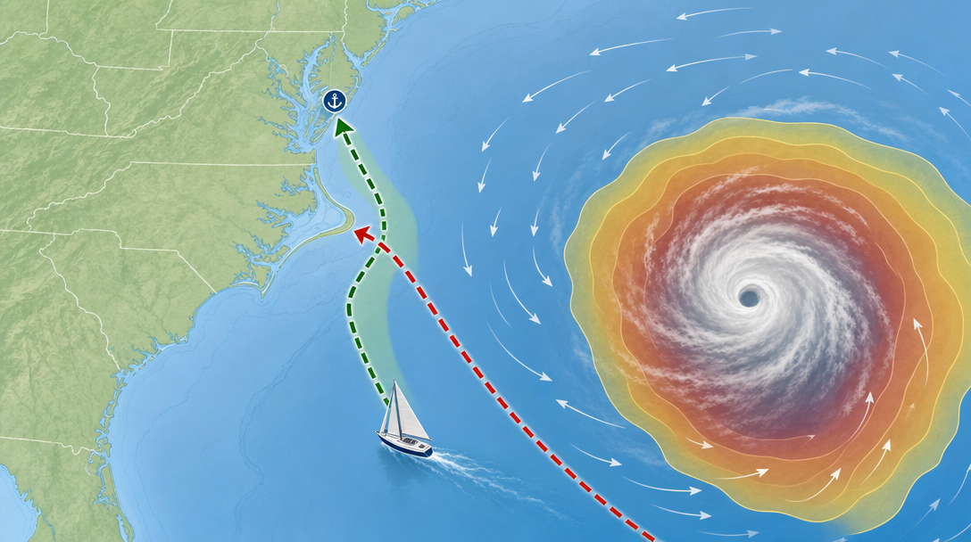
If there's even the slightest chance of avoiding a storm, good maritime practice is to make a pre-sea port call. It's often safer to wait a couple of days in Charleston and then continue north through calmer waters. The worst thing is to be caught between the storm and the New England coast, where a cyclone can bring hurricane-force gusts.
Late decisions are dangerous because shallow inlets with bars instantly become impassable due to crashing waves. For example, on the New Jersey coast, only Atlantic City remains safe in a 40-knot easterly wind. Knowing when a yacht should seek shelter during a storm boils down to a simple rule: choose a port and set a safe course before the wind makes the vessel unmaneuverable.
A tropical storm cannot be judged by its name alone.
Even if a system isn't classified as a hurricane, tropical storms pose an extremely high risk to a yacht. These cyclones bring winds of 35 to 65 knots and generate dangerously steep waves. The problem is compounded by the fact that the storm often moves at 15 to 20 knots. Trying to get ahead of it on a cruising yacht traveling at six or seven knots usually results in the vessel being overtaken by the elements.
Moreover, tropical systems can undergo unpredictable structural changes—losing their warm core, forming extensive fronts, and growing in size. The infamous Hurricane Sandy began as a normal storm, but developed into a gigantic extratropical cyclone before making landfall. Therefore, the decision to remain at sea or immediately abort the cyclone should depend on its actual dynamics, not its official category.
- Is it clear which nearest port will remain accessible given the current deterioration in conditions?
- Will the crashing waves on the bar block safe access to the marina?
- Does the schedule allow you to wait out the bad weather on the shore and continue sailing in calm water?
- Is a storm system moving in faster than the ship can get out of its way?
The decision at the transition begins with observations, not with a single prediction
The computer model only provides a preliminary picture. Actual wind conditions, barometric readings, cloud cover, and wave height reveal what's actually happening in the ocean. A favorable Gulf Stream meander can add a couple of knots of speed, but it can also trigger a sudden, violent squall, and sailing close to a tropical cyclone can cut off escape routes in a matter of hours.
Therefore, before leaving the harbor or at the first sign of deteriorating weather, it is worth asking yourself four control questions:
- Does the surrounding sea weather match the morning report?
- How to use the Gulf Stream meanders during transit to avoid getting stuck in severe thunderstorms?
- Is there time left to reef and tack safely?
- Is there a safe harbor available if the wind picks up early?